© 2024 Association La Ferme Digitale – All rights reserved
Kermap
Description
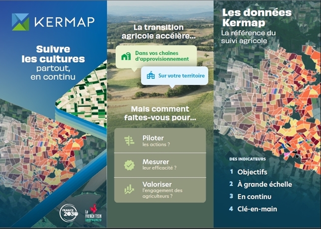
Kermap supplies strategic geospatial information based on innovative AI-driven satellite analysis, providing geointelligence and decision support services to help local authorities’ and businesses’ efforts towards environmental conservation and climate resilience. Specifically, Kermap’s Nimbo solution provides turnkey analytics on land use, with a focus on field and crop monitoring up to the continental scale. Such data helps the farming industry address supply chain optimization issues or quantify transitions to sustainable agriculture practices.
Kermap's solution provides continuous monitoring of farmland cover via Nimbo's APIs, currently supplying near-real time data on 200 millions hectares of crops across Europe. These data help water agencies, farm coops, agrobusinesses and NGOs assess compliance to agroenvironmental measures as well as monitor progress over their multi-year transition programs. Kermap for instance monitors farmland regeneration across +20,000 fields throughout France, providing exclusive analytics on soil health, biodiversity, carbon sequestration and water resources. Field- or farm-scale data are available on the fly and instantly user-ready to activate transition incentives schemes.